


For just a few days each month, when the tide recedes to its lowest level, a rare phenomenon occurs in the waters of Nhon Hai and Hai Giang (Quy Nhon Dong ward, Gia Lai province; formerly part of Quy Nhon city, Binh Dinh province). Amidst the blue waters, a 'wall' stretching for kilometers under the sea gradually emerges, resembling a fortress submerged by the ocean.
The unique shape of the rock formations often leads first-time visitors to question: Is this a man-made structure or simply a masterpiece of nature? To this day, the answer to this mystery remains elusive.
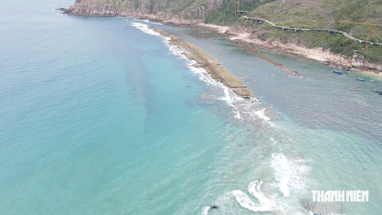
The rocky outcrop at Nhon Hai, stretching for kilometers, is only visible when the tide recedes, creating the image of a giant 'wall' in the middle of the Quy Nhon sea.
PHOTO: DUC NHAT
Two strange 'walls' in the middle of the sea
We arrived at Nhon Hai beach in the afternoon when the tide was low. The seawater receded far from the shore, revealing a long stretch of rocks that resembled a natural breakwater. The rocks were quite flat, with many square sections, looking like a fortress wall from a distance.
This is also the busiest time for tourists. Many people take advantage of the opportunity to walk along the rocky strip to take photos and explore the underwater 'wall' in Quy Nhon, which only appears for a few days each month.
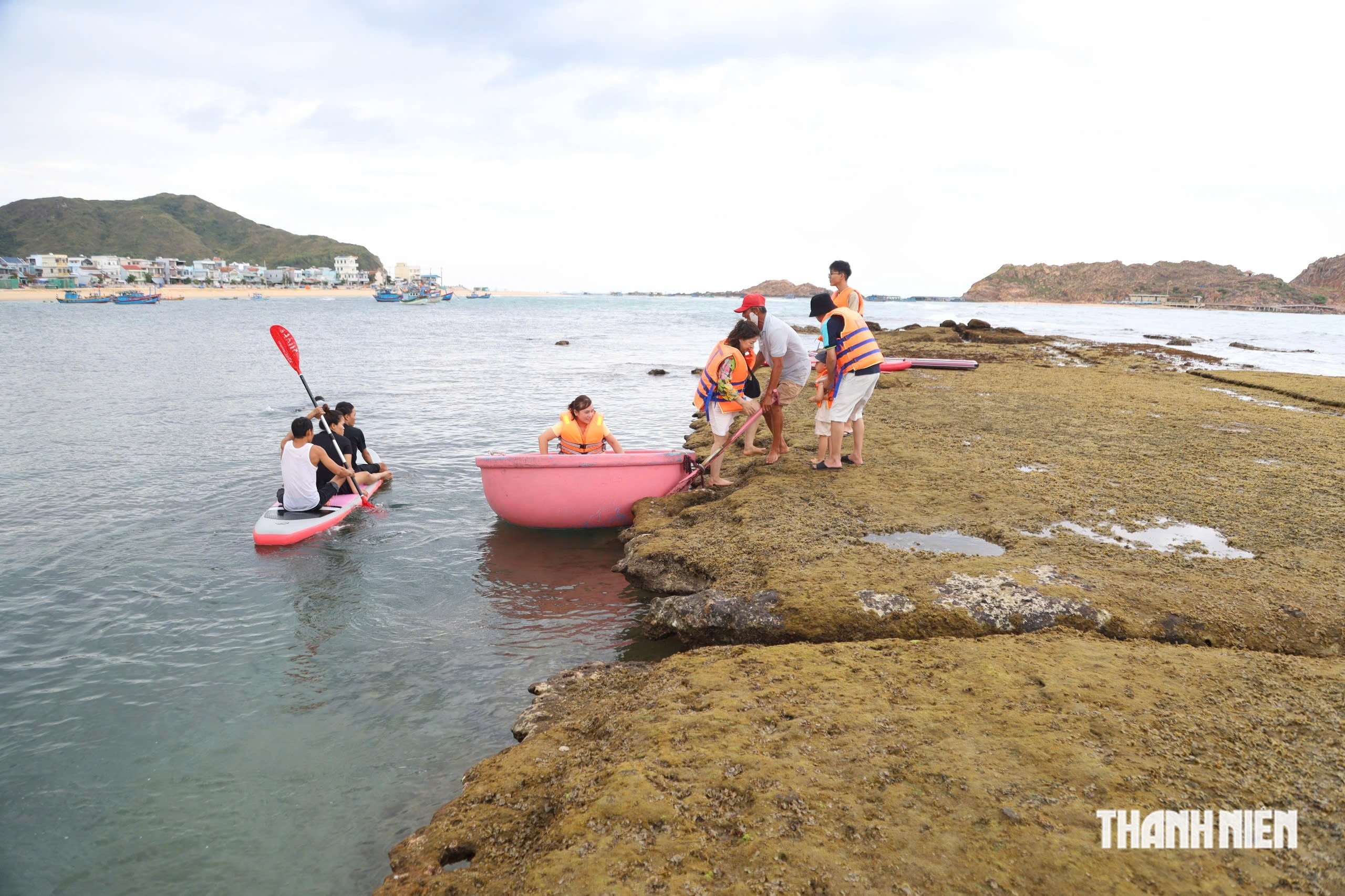
For only a few days each month, when the tide recedes deeply, the Dam Embankment is revealed, attracting many tourists to visit and explore.
PHOTO: DUC NHAT
Locals call this rock formation the Dam Shore. Located underwater in Nhon Hai, the structure is approximately 40-60 meters wide and stretches for nearly 1.5 kilometers from the Lower Cliff to Hon Kho Island.
The embankment has many natural fissures. At both ends of the rock formation, there are wide openings of about 50 meters, which are currently used by fishermen as passageways for boats to enter and exit the harbor.
About 1 km away as the crow flies is Cau Reef, stretching nearly 3 km along the Hai Giang coastline, from Mui Thap headland to the Ngoi area. Unlike Bo Dap Reef, which is located further offshore, Cau Reef is closer to the shore, only about 3-4 meters wide, but it still gives the impression of a rock wall running parallel to the coastline.
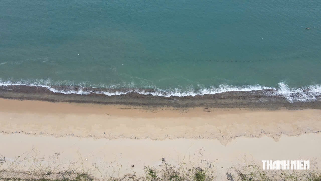
The 'wall' of Rạn Cầu (in Hải Giang) lies close to the coastline, about 3-4 meters wide, extending as a strip of rocks parallel to the coastline, giving the impression of a natural wall.
PHOTO: DUC NHAT
The two rock formations share a fairly similar structure. The rocks, of varying sizes, are connected in a long strip, with relatively flat surfaces covered in algae, oysters, clams, and various marine mollusks.
Because they are mostly submerged, the full shape of the two rock formations only becomes apparent on days when the tide recedes significantly, usually in the middle and end of the lunar month.
While the Cau Reef is currently located within a tourism urban development project area, making it quite difficult to access, the Dam Bank, situated in the Nhon Hai fishing village, has become a popular tourist attraction and photo spot.
However, what interests researchers is not just the beauty of the two rock formations, but also their true origin.
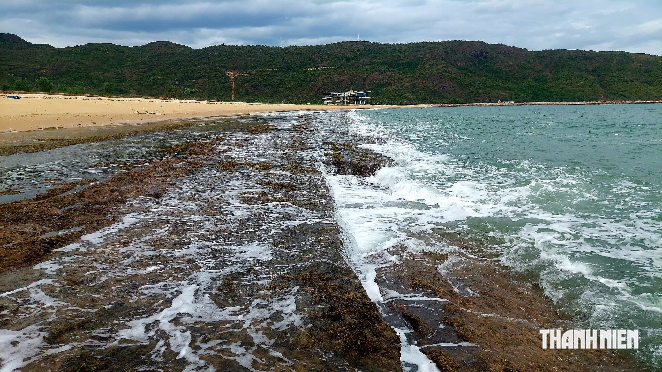
The Rạn Cầu reef is located within an ongoing urban tourism project, making it quite difficult to access.
PHOTO: DUC NHAT
Natural or man-made?
Over the years, numerous theories have suggested that the 'wall' under the sea in Quy Nhon is the remains of an ancient fortress, with some even linking it to the ancient Champa people.
According to the Gia Lai Provincial People's Committee's inventory of historical relics, the two rock formations are described as "two ancient underwater walls," exposed at low tide on the middle and end days of the lunar month. Furthermore, this area is considered to have significant architectural, historical, cultural, and archaeological value, requiring continued protection and research.
However, according to Mr. Nguyen Thanh Quang, a member of the Standing Committee of the Gia Lai Provincial Historical Science Association, the available data is insufficient to confirm that this is a man-made structure.
He stated that the formations of the Dam and the Bridge Reef are quite similar to the natural rock formations previously recorded on Ly Son Island ( Quang Ngai ). To date, there are no official historical records mentioning the existence of an underwater fortress in this area.
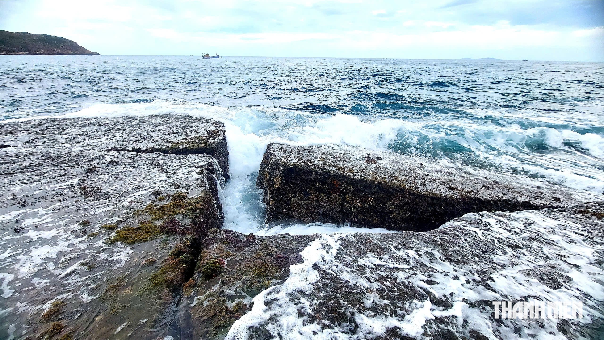
The "wall" of the embankment in the Nhon Hai sea area only becomes visible when the tide recedes significantly.
PHOTO: DUC NHAT
According to Mr. Quang, if it is considered an artificial structure, then a series of questions need to be answered, such as who built it, when it was constructed, what techniques were used in its location below sea level, and what purpose it served. "To date, there is no scientific evidence sufficient to answer those questions," Mr. Quang stated.
From a geological and historical perspective, he leans towards the possibility that this is a natural landform formed through the long-term movement of the sea.
Archaeology opens new avenues for deciphering the code.
While many researchers lean towards the geological hypothesis, the survey results from the Vietnam Institute of Archaeology open up a different approach to the two underwater "walls" in Quy Nhon.
In November 2024, the Gia Lai Provincial Museum, in collaboration with the Vietnam Institute of Archaeology and local authorities, conducted a field survey at Bo Dap and Ran Cau. The research team collected sediment, mollusk, and geological layer samples for analysis.
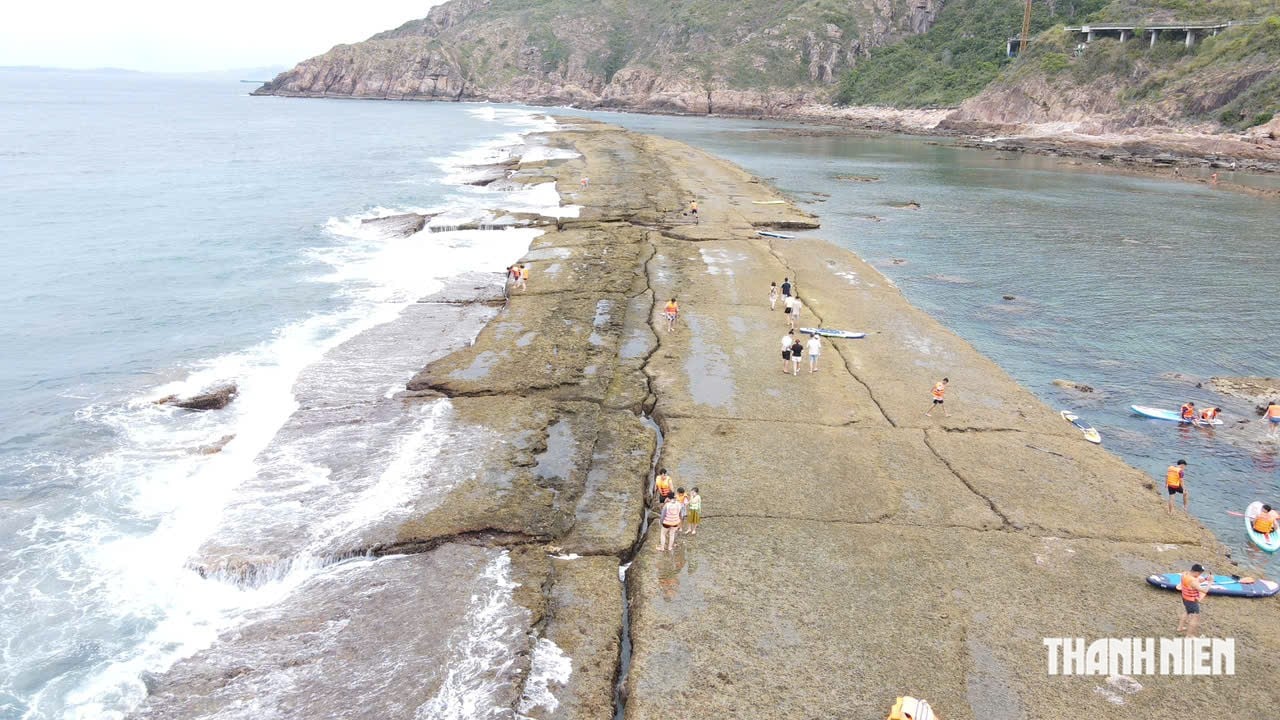
Only for a few days each month, when the sea level is at its lowest, can visitors set foot on the Dam Shore.
PHOTO: DUC NHAT
Preliminary results indicate that the two rock formations were primarily formed by the deposition of sediments in a marine environment over several periods. Layers of sand, marine organisms, and sediments gradually accumulated, creating the current structure.
Carbon-14 isotope analysis of mollusk samples in surface sediments determined that this area was deposited between approximately 1,000 BC and around 700 AD.
Based on the initial data, the research team hypothesized that the inhabitants of the Sa Huynh - Champa culture may have utilized natural rocky shores as anchorages, breakwaters, or shelters for boats during storms.
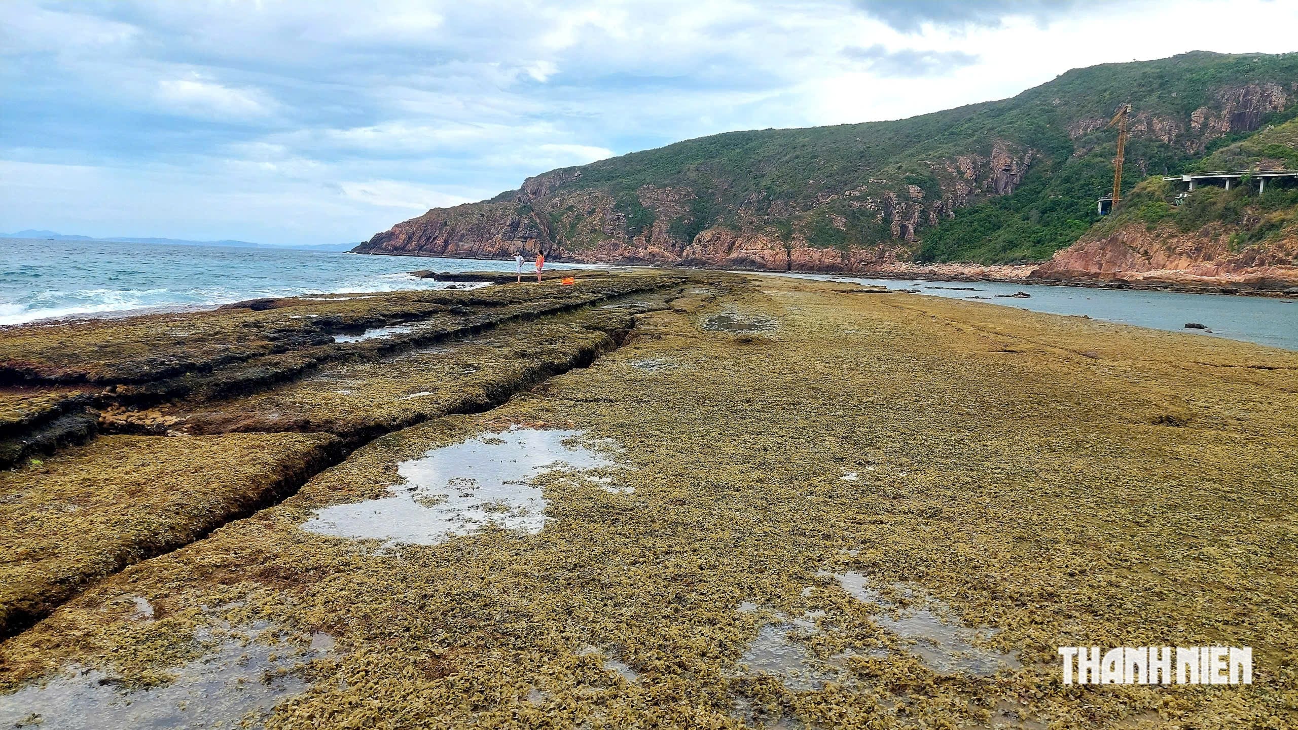
When the tide recedes, the surface of the rocky reef at Nhon Hai is covered with algae and mollusks.
PHOTO: DUC NHAT
If this hypothesis is proven, the Dam and the Reef will not be an "underwater fortress" as many have imagined, but rather a mixed heritage site: nature created the foundation, while humans exploited and modified it to serve their lives.
According to Mr. Bui Tinh, Director of the Gia Lai Provincial Museum, the Dam Embankment and the Cau Reef have only recently been included in the inventory of historical relics and have not yet been classified as provincial-level historical relics.
To accurately determine the nature of the two rock formations, specialized agencies need to continue archaeological excavations, geological research, and determine their age, function, and intended use. Without sufficient scientific evidence, it is impossible to definitively say whether these are archaeological sites or simply natural geological phenomena.
The biggest challenge is that the entire area is underwater, requiring specialized diving equipment and coordination from multiple fields such as archaeology, geology, oceanography, and geomorphology for the survey.
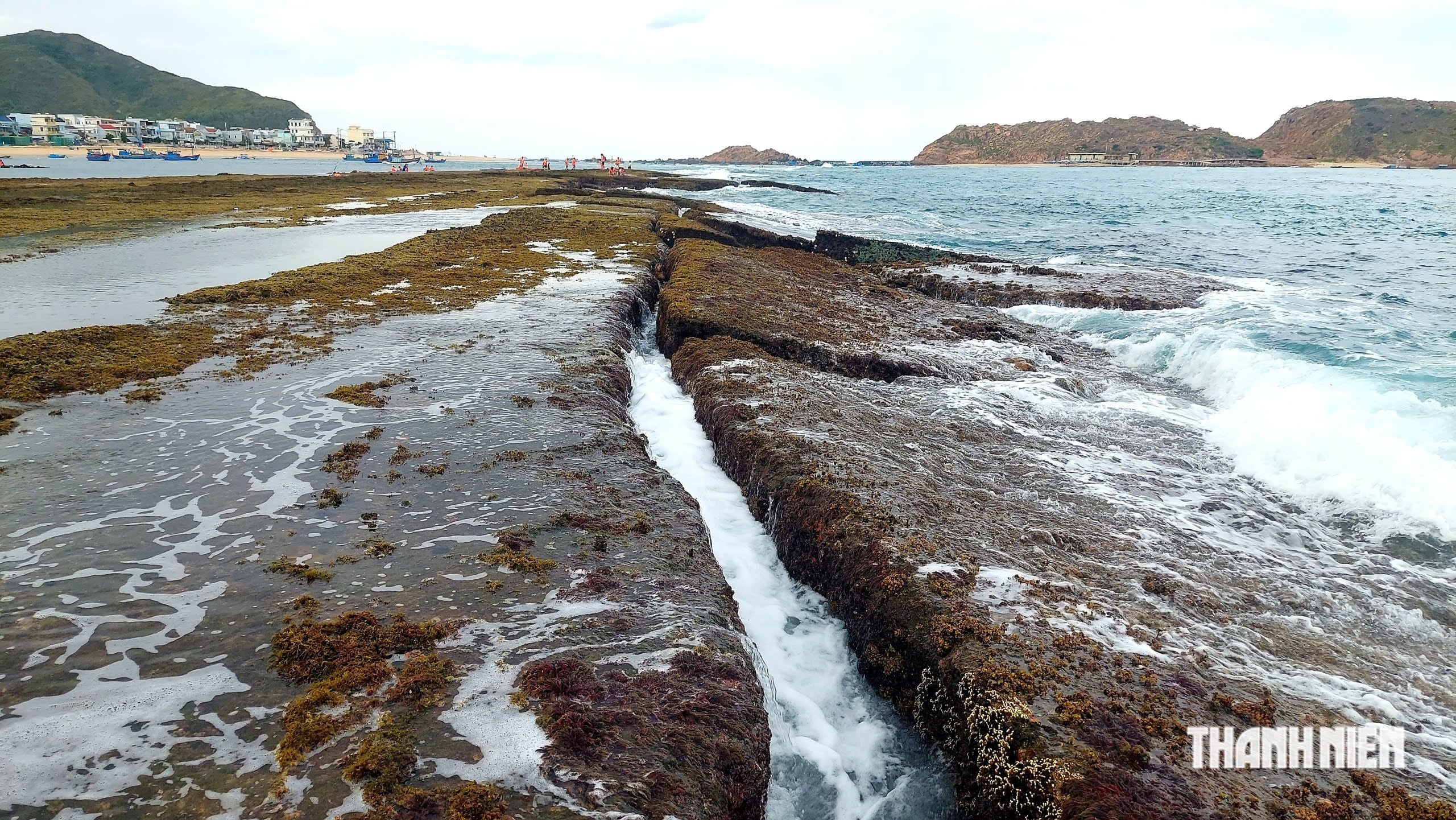
The Bờ Đập rock formation is approximately 40-60 meters wide and stretches for nearly 1.5 kilometers.
PHOTO: DUC NHAT
Currently, the Gia Lai Provincial Museum is continuing to cooperate with the Vietnam Institute of Archaeology and the Center for Research on the Imperial City to conduct in-depth surveys to clarify the origin of the two stone formations. Until more scientific evidence is available, the question of whether these are traces of human activity or masterpieces of nature remains open.